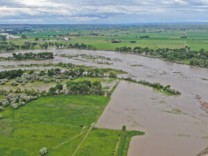
The Yellowstone River is running out of its banks in this 6/13/22 drone image near Shepherd at Arrow Island. More Drone images at end of story. (Drone image by Jonathan McNiven)
As of 5 pm on Monday, June 13, the National Weather Service issued flood warnings for the Yellowstone and Stillwater Rivers. The warning follows two days of significant flooding of streams at higher elevations – flooding that is devastating the town of Red Lodge and has closed roads in numerous places including Yellowstone National Park, the upper Stillwater, and the highway between Gardiner and Livingston.
Flood levels measured on the upper Yellowstone River are beyond record levels.
Flooding is threatening the town of Joliet and residents are being asked to prepare for evacuation.
Some reports claim that the Clarks Fork River is at record flood levels.
Rock Creek in Red Lodge has broken through its banks and waters are flooding more than half the town from the creek at the town’s eastern edge to beyond Main Street where river water is flowing two feet deep.
Yellowstone Park announced that it is closed for several days due to “extraordinary flooding and road damage. Gardener is isolated and needs assistance.”
Reports are that helicopters are air-lifting people out of the Stillwater Mine area, which has been cut off because of a washed out road, and out of Gardiner, where flooding and landslides have blocked the road and have left tourists stranded since Yellowstone Park Roads have also been closed.
The National Park Service announced that it is working with the gateway communities to evaluate flooding impacts and provide support to residents.
The extraordinary flooding is believed to be the result of the melting of record snow pack in the mountains and significant rainfall throughout the area over the past couple of weeks. Rainfall is expected to continue for the next several days and temperatures are expected to reach 100 degrees on Friday.
Prior to the heavy rainfall of the last few weeks — which fell as snow in all of Montana’s southern and western mountain ranges — most areas had very low mountain snowpack of about 70 percent. Last week the National Weather Service reported that the snowpacks had increased to 177 percent in the Beartooths and higher in many other western mountain ranges; in some cases exceeding 200 percent of average snowpack.
NorthWestern Energy issued a press release announcing that crews are working to repair damage to power lines, poles and other equipment caused by strong storms and flood water across southern Montana.
NorthWestern Energy crews are working with local emergency service agencies to access equipment safely in flood-damaged areas. They warn citizens to stay away from all damaged and downed power lines. If you smell natural gas, leave the area immediately– do not use a phone, match, light switch or anything else that could trigger the ignition of gas. When at a safe distance, call 911 to report the gas smell.
People in Yellowstone County who believe that they may need sand bags are advised to contact their local fire departments. The County Public Works Department is distributing bags to rural fire departments.

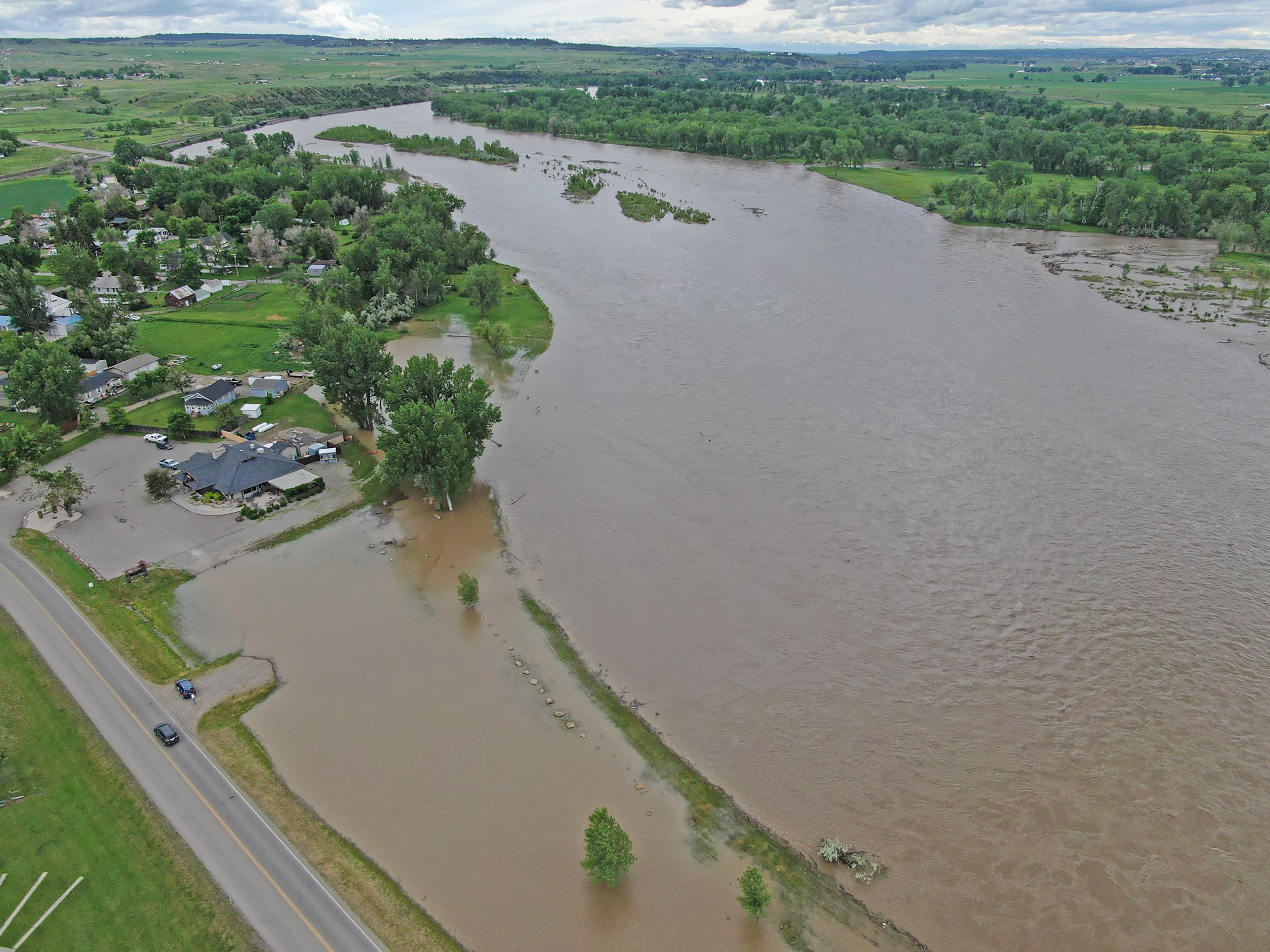
The Yellowstone River is out of it’s banks in Huntley near Cowboys Bar and Restaurant. This drone image was taken Monday 6/13/22 afternoon with flood waters expected to peak Tuesday about 1pm. (Drone Image by Jonathan McNiven)

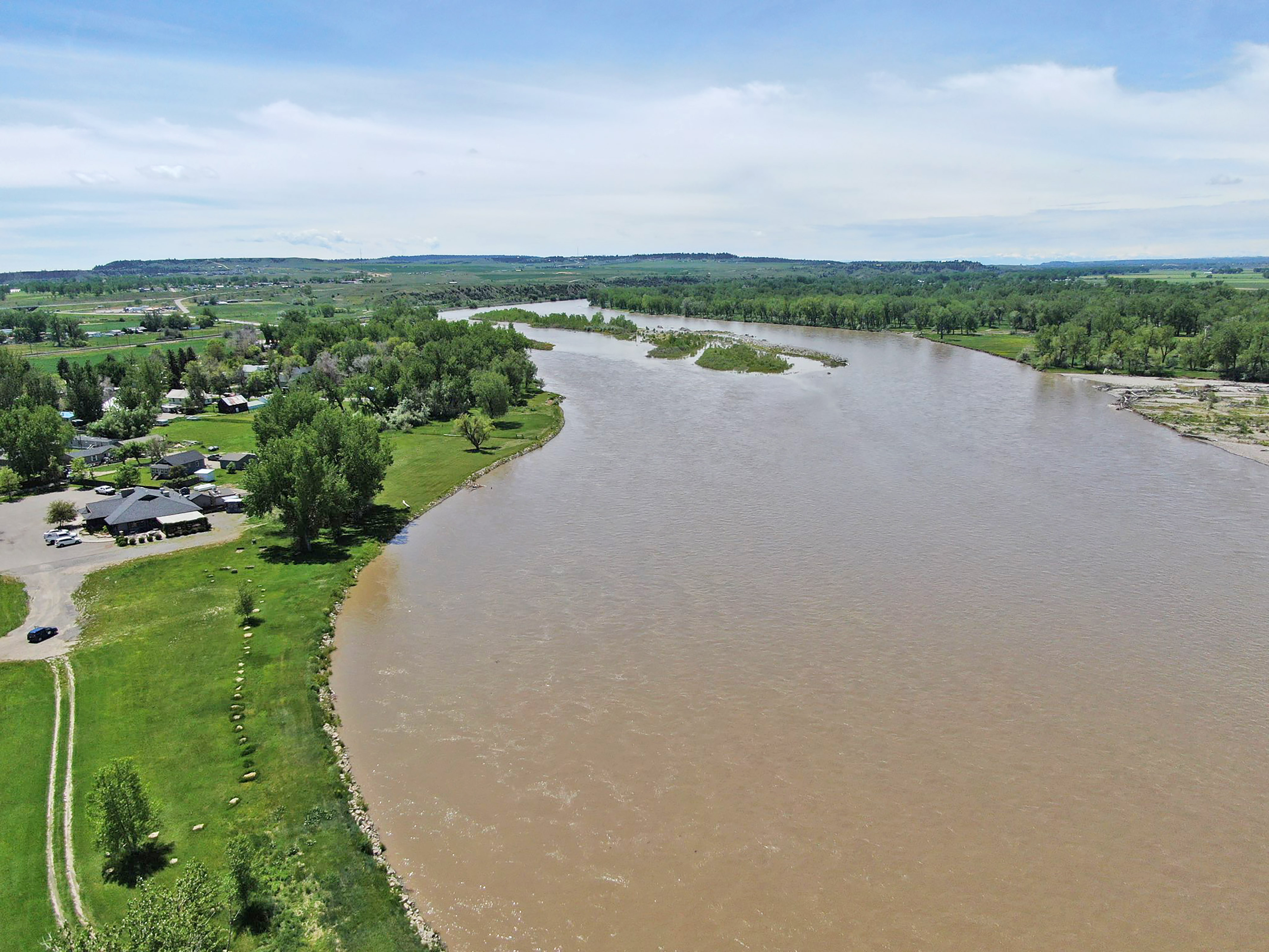
This drone image was taken 6/8/22 of Cowboys Bar and Restaurant in Huntley when the Yellowstone River was still in its banks before flooding started to occur. (Drone image by Jonathan McNiven)

